OpenConsult

OpenConsult is an award-winning cloud-based consultation platform. It captures text and map-based submission data that powers flexible reporting dashboards for you and your stakeholders. This new approach enables communities & cities to benefit from the collective knowledge of citizens during consultations, leading to more informed responses, stronger policy/planning and savings.

Play Video

Smart, open engagement

OpenConsult provides you maximum flexibility to open your data and conversations around your consultations. Harness the collective knowledge of your stakeholders for deeper engagement and richer insights.

Versatile

Consultation, surveys and more ways to consult.

Accessible

Accessible to visually impaired participants and fully mobile friendly.

Flexible

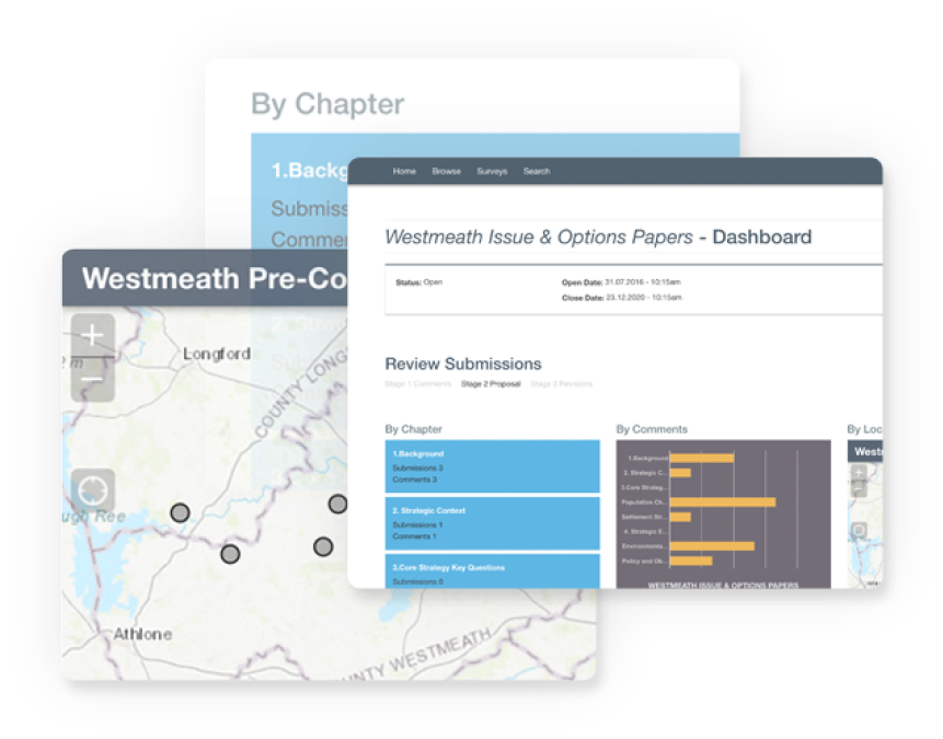
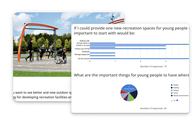
Summarise your submissions, tag and run flexible reports.

Multi-lingual

Multi-lingual consultation interface to communicate with all of your citizens or stakeholders.

Granular

Manage permissions to access your consultation and its data.
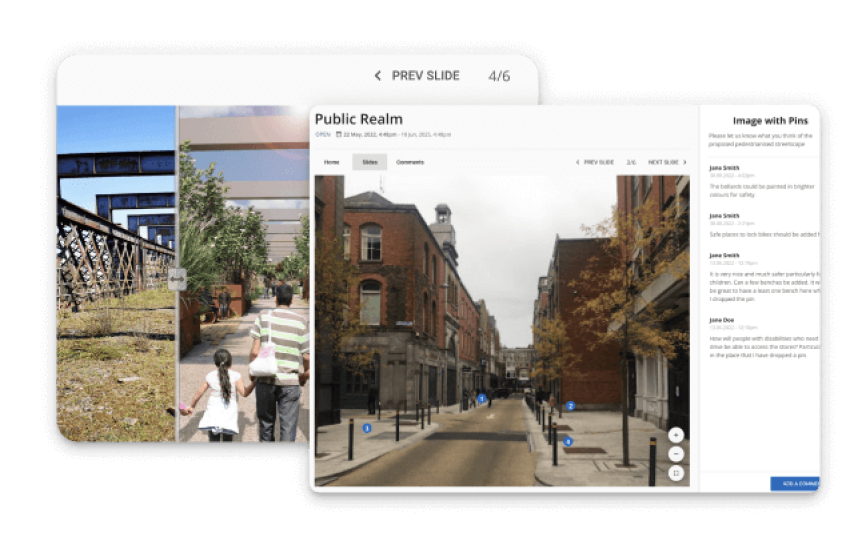
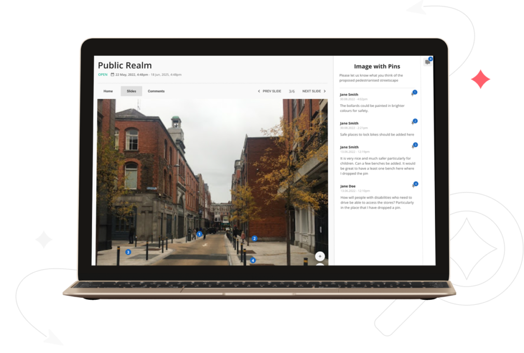
Interactive

Lots of interactive ways to create a sense of community around your consultation.

Interactive Documents

Why publish a large PDF, when you can create an interactive document? With OpenConsult you can create a user and mobile friendly version. This ensures everyone can access the document on the fly, on the bus, including users with visual impairment. Maps and images can be displayed also accessibly through a viewer.

Interactive Maps

OpenConsult has interactive maps to help citizens view map-relevant data and draw their area of interest. If you use ArcGIS Online you can use your webmaps and receive all submissions back into your map system

Open Visualisation & Reports

Choose to open your consultation dashboard, query and reporting functionality to your citizens, stakeholders or consultees. Help others to explore feedback and what aspects of your consultation are receiving comments – during the consultation – when it matters most.

Note drop

Users can engage visually with image, videos and maps and participate in a conversation with others. Users can drop pins at the location to which their comments refer.

Surveys

Our survey creator guides to you to set up your survey
  • Add all question types tables, text, grids, matrices etc
  • Add images, videos and interactive maps
  • Find consensus on options using the Modified Borda Count method Run dynamic reports

OpenConsult for planners

Discover how OpenConsult is used to create Local Development Plans. Understand OpenConsult features and view examples of development plans.

Consultations and Surveys

Engagement format for day-to-day stakeholder engagement, with visual consultations and surveys. Here are some examples.